Designing a Survey That Can Actually Find Something
The survey that was designed to fail
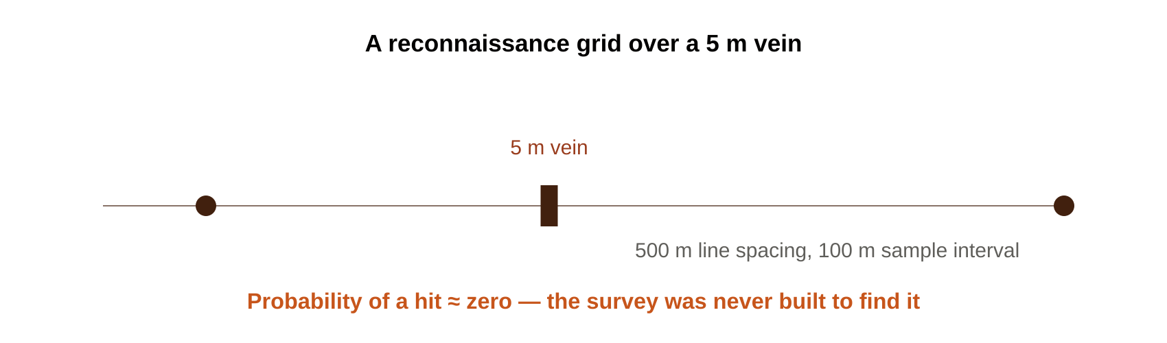
Picture a narrow gold vein, five meters wide, sitting under a reconnaissance grid with lines 500 m apart and samples every 100 m. The probability of a single sample landing on that
vein is close to zero — not because the crew did anything wrong in the field, but because the survey was never built to find something that size.
This is the uncomfortable truth about soil geochemistry: the survey is usually won or lost before the first sample bag is filled. Everything downstream — QA/QC, interpretation, drill targeting — depends on decisions made at the design table.
What decides success before fieldwork begins
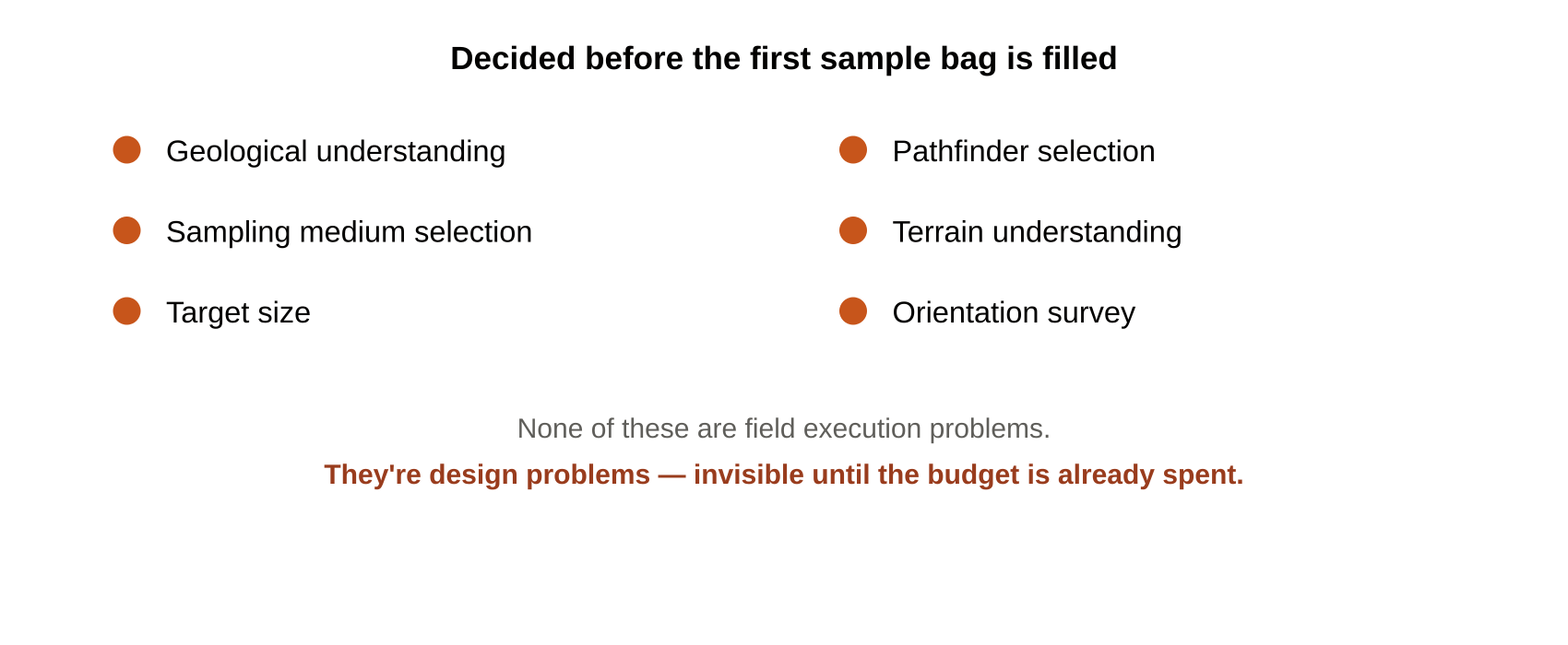
A handful of planning-stage factors determine whether a survey has a real chance:
None of these are field execution problems. They’re design problems, and design problems don’t show up until the results come back wrong — by which point the budget is already spent.
Grid spacing has to respect the target, not the budget
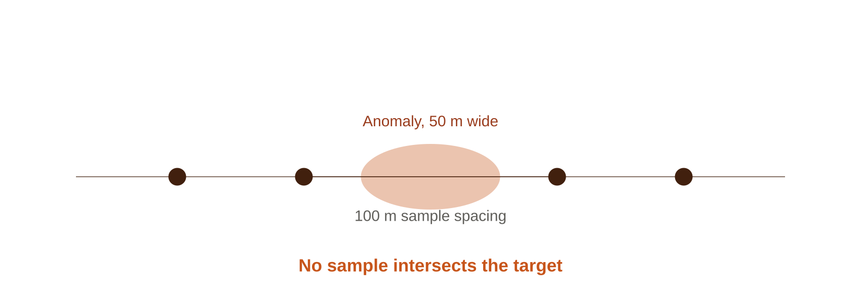
This is where the math gets unforgiving. If an anomaly is 50 m wide and your sample spacing is 100 m, it’s entirely possible for the pattern to look like: sample — anomaly — sample, with no sample point ever intersecting the target. That’s not bad luck. That’s a false negative built into the survey design.
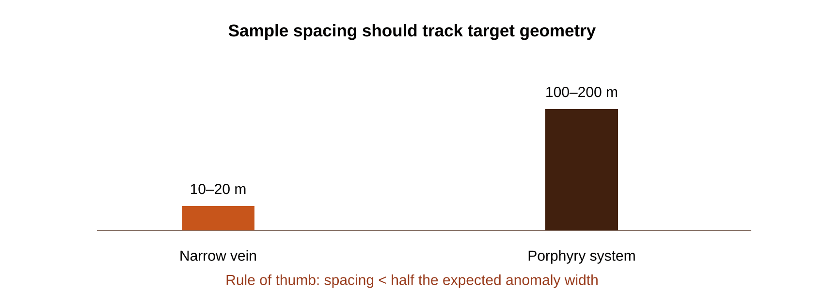
Target geometry drives the numbers directly:
The general rule: sampling interval should be less than half the expected anomaly width — preferably closer to a quarter of it. Skipping this calculation is one of the most expensive mistakes in exploration, because it’s invisible until someone asks why a promising-looking area came back “clean.”
Why sampling lines should cross the strike, not follow it
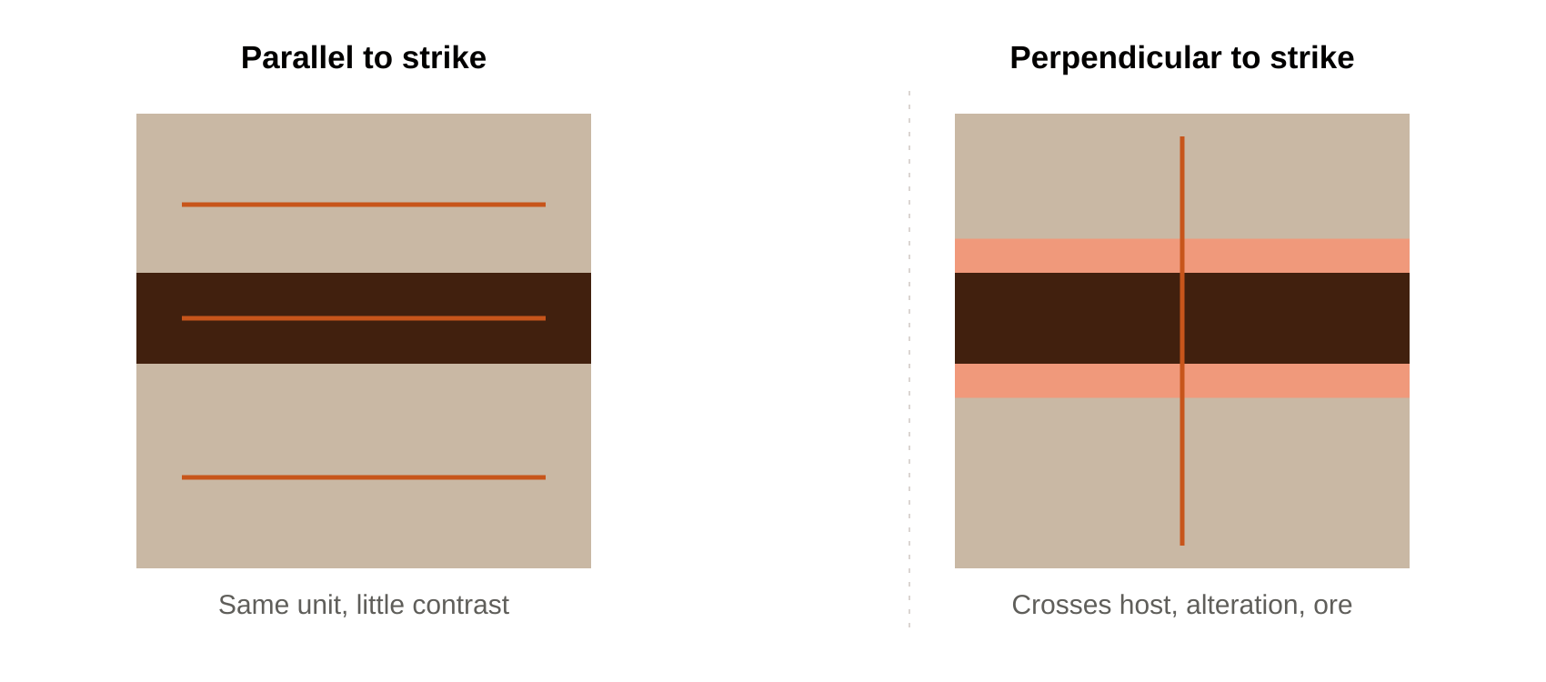
Sample lines run parallel to geological strike stay inside the same rock unit the whole way — host rock the entire traverse, with little contrast to detect. Lines run perpendicular to
strike cross host rock, alteration zone, mineralized zone, and back to host rock, maximizing the chance of catching real contrast in the data.
This is a simple orientation decision, but it’s one that gets overlooked surprisingly often on greenfield ground where the structural grain isn’t obvious yet — which is exactly why
geological mapping has to come before, or alongside, survey layout.
Getting this right across varied terrain is part of the daily work on our Tanzania licenses — structural orientation looks different walking a shear zone near Nzega than it does across a graphitic horizon in Lindi, and survey design follows the geology, not a template.
When reconnaissance is a waste of money
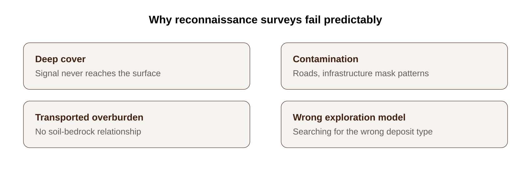
Reconnaissance surveys — wide-spaced, low-cost, first-pass — have their place, but they fail predictably when the expected anomaly is smaller than the sampling interval.
Beyond target size, reconnaissance can also fail because of:
The underlying lesson holds across all of these: survey scale must match target scale. A reconnaissance grid designed for a broad porphyry system will reliably fail to detect a
narrow gold vein system, regardless of how carefully the fieldwork is executed.
Download the Investor Deck →
to see how this scale-matching discipline shapes our program design across the Kahama, Nzega, and Geita gold clusters.
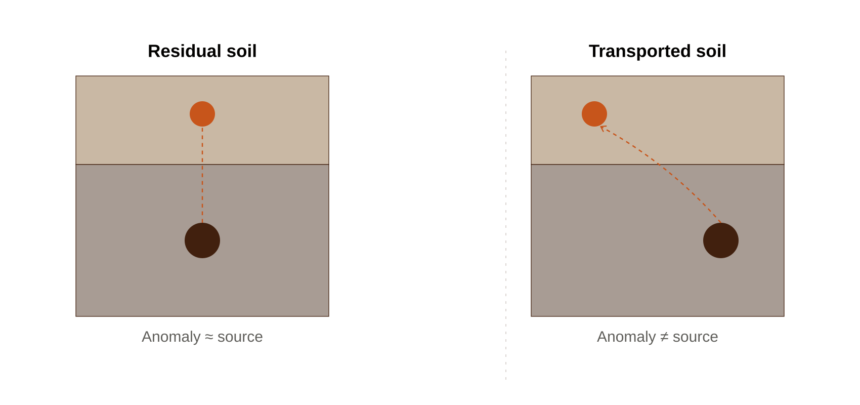
Designing around cover: transported ground and buried targets
Two related design challenges deserve their own attention, because they’re common across greenfield terrain like much of Tanzania’s exploration ground.
Design first, drill later
A perfectly executed field program built on a flawed design will still miss the target. This is why, on every new license — whether it’s a fresh gold target near Jomu or an early-stage
graphite assessment in Tanga — the design phase gets as much rigor as the fieldwork itself.